EXECUTIVE SUMMARY
Safe and clean water is one of the basic human needs which is not available in most areas around the world. In most of the urban and rural areas, people do not have access to pure and clean drinking water.
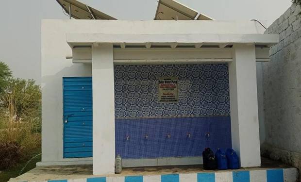
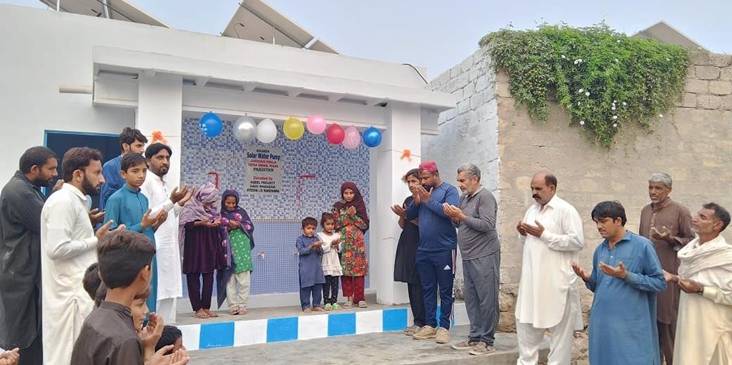
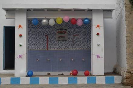
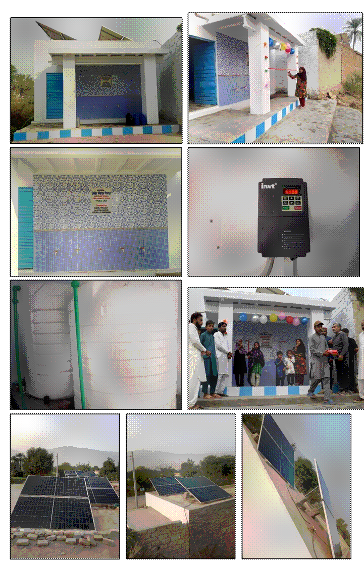
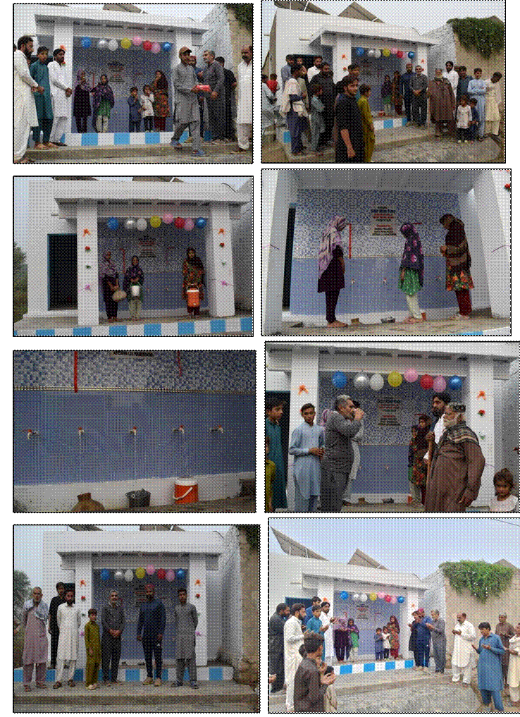
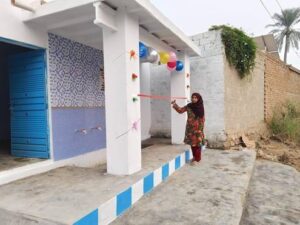
Drinking water for community is the very common utility, therefore, a Solar powered Water Plant was installed in a village Judgan
Wala of district Dera Ismail Khan; Khyber Pakhtunkhwa in
November 2024, which was sponsored by Aqeel Project: Hadi Shahzad, Ayesha Liu Randhawa.
All the villagers were extremely pleased and thankful.
1. DEFINITION & ABBREVIATIONS
1.1 Definitions
| Project: | Water for Life
Solar Power Water Plant |
| Taluka:
|
Tehsil |
| Mauza: | Towards the specified place or direction |
1.2 Abbreviations
| Dia | Diameter | |
| ft | Feet | |
| Km | Kilometers | |
| WFL | Water for Life | |
| SPP | Solar Power Water Plant | |
| Km | Kilometers | |
| KW | Kilo watt | |
| hr | Hour |
2. AIMS & OBJECTIVES
2.1 Aims
Following are primary goals of the project:
- To provide access of drinking portable water through Solar Power Water Plant for the local communities in proximity of their abode. Hence, enabling them to obtain clean drinking water
- To provide complete solutions to the community which will allow the people to get clean drinking water from the nearest provided source
2.2 Objectives
The main objective of the project is to provide drinking water through Solar Power Water Plant in different Districts of Pakistan.
The following details illustrate project:
Project: Water for Life; Solar Power Water Plant
Location: All Districts of Pakistan
3.OVERVIEW OF PROVINCES
3.1 Overview of Punjab
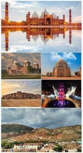
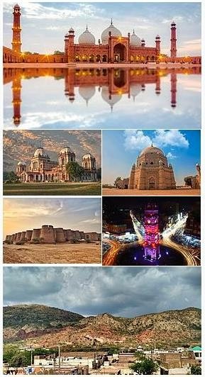
Punjab, Pakistan’s most populous and second-largest province by area, is renowned as the land of five rivers and historically acclaimed as the granary of the east, serving as the nation’s vital cornerstone.
Predominantly encompassing plains, the province also features hilly terrains in the North-West and extreme South-West. Notably, it includes distinct geographical regions such as the Potohar plateau adjacent to the mountains and the Cholistan desert in the South-East.
This province witnesses the passage of major rivers— Indus, Jhelum, Chenab, Ravi, and Sutlej—originating from the Himalayas and traversing from North-West to South-West. Their flow intensifies during summer due to monsoon rains, occasionally leading to floods. Punjab houses several major cities in the country, including Lahore, Faisalabad, Rawalpindi, Multan, and Gujranwala.
Primarily an agricultural hub, Punjab’s economy thrives on farming activities, although industry significantly contributes to its economic landscape. It stands as a key player in the country’s agricultural production, contributing around 68% to the annual food grain output. With 51 million acres under cultivation and an additional 9.05 million acres of cultivable land, Punjab focuses on crops like cotton and rice, substantial cash crops boosting the national treasury.
Efforts to achieve agricultural self-sufficiency have shifted strategies towards promoting small and medium farming, emphasizing barani areas, constructing farms-
to-market roads, electrification for tube-wells, and tackling waterlogging and salinity issues. The province boasts over 48 thousand industrial units, including an abundance of small and cottage industries. Among these, there are 39,033 small and cottage industrial units, 11,820 textile units, and 6,778 ginning industries. Additionally, Punjab houses 6,355 units for processing agricultural raw materials, such as food and feed industries.
Distinct areas excel in specific industrial productions; for instance, Sialkot district stands out for sports goods, surgical instruments, and cutlery. Moreover, Punjab is rich in minerals, with extensive deposits of coal, rocksalt, dolomite, gypsum, and silica-sand. The Punjab Mineral Development Corporation oversees over a dozen economically viable projects related to mineral development.
| Location | ||
| O Country | : Pakistan | |
| O Province | : Punjab | |
| Temperature | ||
| O Maximum Temperature | : 52 °C | |
| O Minimum Temperature | : -2 °C | |
| Demography | ||
| O Total Population (2017) | : 109 Million | |
| O | Population Density | : 535.63 / Km2 |
| O | Total Area | : 205,344 Km2 |
| O | Annual growth rate | : 2.13 % |
| O | Literacy | : 64 % |
| O | Language | : Saraiki, Urdu, Punjabi, English, Pothohari |
| Boundari | es | |
| o | North | : Islamabad Capital & Azad Kashmir |
| O | North East | : Azad Jammu and Kashmir (AJ&K) |
| O | South West | : Balochistan Province |
| O | West | : Khyber Pakhtunkhwa (KPK) Province |
| O | South | : Sindh Province |
| O | East | : Indian states of Punjab and Rajasthan |
| District Administrative Units | ||
| O Divisions | :9 | |
| O Districts | :36 | |
| O Tehsils | :146 | |
| O Union Councils | :7602 | |
3.2 Overview of Sindh
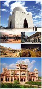
Sindh, derived from the Sanskrit word ‘Sindhu’ meaning river or ocean, was chosen to signify the mighty Indus
River, the primary waterway encountered by the Aryan invaders. Situated in the southeastern part of Pakistan, Sindh ranks as the country’s third-largest province in terms of total area and second largest in population, following Punjab.
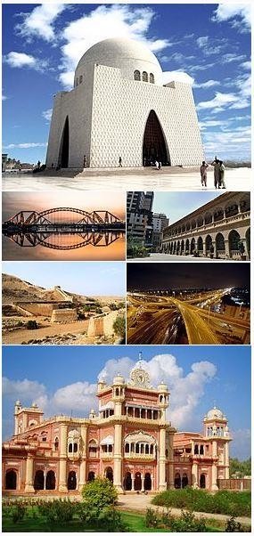
This region held significant prominence as the heart of the Indus Valley Civilization for centuries. Evidence points to an advanced urban civilization established at Kot Diji in central Sindh dating back to 3300 B.C.E., serving as a precursor to the flourishing Indus Valley Civilization that prospered in the area for the subsequent 2,000 years. The advent of Islam occurred when Arab invaders arrived in the 8th century C.E., leading to the development of the Sindhi language inscribed in the distinctive Nakshi script derived from Arabic.
Throughout history, the region came under the dominion of the Mughal Empire in the 17th century, with Muslim rulers initially operating through the local Kalhora clan and later through the Talpurs from northern Sindh. However, in 1843, two decisive British military victories altered the landscape, placing Sindh under the rule of the Bombay Presidency, an administrative division of British India.
Geographically, Sindh is positioned between the southwest monsoon from the Indian Ocean and the northeast or retreating monsoon, evading the direct influence of both. The area’s limited rainfall is compensated by the Indus River’s biannual inundation, caused by the melting of Himalayan snow in spring and summer, coupled with monsoon season rainfall.
Sindh is delineated into three distinct climatic regions: Siro
(upper region, focused on Jacobabad), Wicholo (middle region, centered on Hyderabad), and Lar (lower region, centered on Karachi). The upper Sindh experiences very dry air owing to the thermal equator passing through, while central Sindh witnesses relatively lower temperatures than upper Sindh yet higher than lower Sindh. Summers in central Sindh bring dry, scorching days and cool nights, with maximum temperatures often hitting 43–44 °C (109–111 °F). Conversely, lower Sindh has a damp, humid maritime climate influenced by southwestern winds in summer and northeastern winds in winter, with comparatively lesser rainfall than central Sindh. Maximum temperatures in lower Sindh hover around 35–38 °C (95–100 °F). The Kirthar range and peaks like Gorakh Hill in Dadu District register near-freezing temperatures in winter, occasionally experiencing brief snowfall.
| Location | ||
| O Country | : Pakistan | |
| O Province | : Sindh | |
| Temperature | ||
| O Maximum Temperature | : 46 °C | |
| O Minimum Temperature | : 2 °C | |
| Demography | ||
| O | Total Population (2017) | : 47.89 Million |
| O | Population Density | : 340/ Km2 |
| O | Total Area | : 140,914 Km2 |
| O | Annual growth rate | : 2.41% |
| O | Literacy | : 58 % |
| O | Language | : Sindhi, Saraiki, Urdu, Punjabi, English |
| Boundaries | ||
| o North | : Balochistan Province | |
| O North East | : Punjab Province | |
| O West | : Balochistan Province | |
| O East | : Indian states of Punjab and Rajasthan | |
| District Administrative Units | ||
| O Divisions | :7 | |
| O Districts | :30 | |
| O Tehsils | :138 | |
| O Union Councils | :1108 | |
3.3 Overview of Khyber Pakhtunkhwa
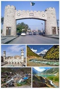
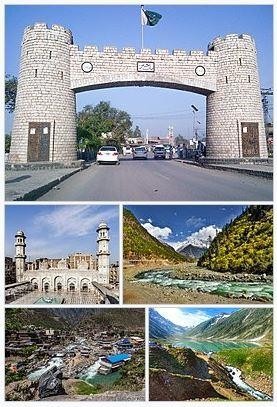
Khyber Pakhtunkhwa, commonly known as KP or KPK and formerly recognized as the North-West Frontier Province, stands as one of Pakistan’s four provinces. Geographically diverse, Khyber Pakhtunkhwa comprises mountain ranges, undulating submontane regions, and plains encircled by hills. The north-south running mountain ranges, located south of the River Kabul, essentially demarcate the province from east to west. The area of the Hindu Kush in the north exhibits breathtaking beauty, with Tirich Mir as its highest peak, while the south of the Hindu Raj accommodates the rugged basins of the Panjkora, Swat, and Kandia rivers, known for frequent mild to moderate tremors.
Geographically, Khyber Pakhtunkhwa divides into two distinctive zones: the northern zone extending from the Hindu Kush to the borders of the Peshawar basin, characterized by snowy, cold winters with substantial winter rainfall and pleasant summers, except for the hotter climate experienced in the capital, Peshawar. The southern zone, spanning from Peshawar to the Derajat basin, witnesses hot summers and relatively cold winters with minimal rainfall.
Endowed by nature, Khyber Pakhtunkhwa boasts a rich cultural heritage and a tourist-friendly environment. The province holds immense potential as a global tourist destination due to its scenic beauty, geographical location, climate, and abundant natural resources. Its allure lies in the picturesque landscapes, comprising stunning rivers, magnificent waterfalls, captivating lakes predominantly nestled in the mountainous areas, and lush green valleys across most regions. Positioned strategically, Khyber Pakhtunkhwa historically served as a melting pot for various civilizations that thrived and faded over time.
The province’s quasi-contiguous connection with Central Asian states and the Xiangyang province of China attracted migrants, traders, warriors, and fortune seekers from diverse backgrounds over different eras, fostering settlements and interactions. This amalgamation of cultures resulted in a rich cultural legacy evident in archaeological sites such as Gur Khattree in Peshawar, Takh-Bahi, Seri Behlol, and Shabaz Gari in Mardan, as well as the Nimo Gram Buddhist Stupa in Swat. Furthermore, a significant collection of Gandhara art is preserved at museums like the Swat Museum, Chakdara Museum in Dir Lower, and the Peshawar Museum.
| Location |
| O Country : Pakistan
O Province : Khyber Pakhtunkhwa (KPK) |
| Temperature |
| O Maximum Temperature : 45 °C
O Minimum Temperature : -1 °C |
| Demography |
| O Total Population (2017) : 35.53 Million
O Population Density : 238/ Km2 O Total Area : 101,741 Km2 O Annual growth rate : 2.8% O Literacy : 53 % O Language : Pashto, Hindko, Saraiki, Khowar, Kohistani, Urdu |
| Boundaries |
| o North / North West : Afghanistan o North East : Northern Areas o South : Dera Ghazi Khan district
O West :Federally Administrated Tribal Areas (FATA) O East : Azad Jammu and Kashmir & Punjab |
| District Administrative Units |
| O Divisions :7
O Districts :35 O Tehsils :105 O Union Councils :986 |
3.4 Overview of Balochistan
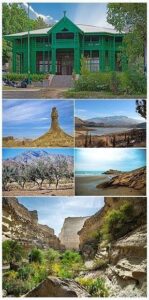
Balochistan, the most extensive among Pakistan’s four provinces, encompasses 43.6% of the nation’s total area yet has a densely scattered population, boasting the smallest proportion among the provinces, with a low population density per square kilometer.
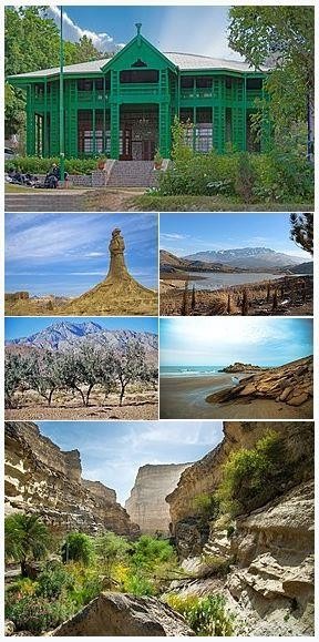
The term “Balochistan” translates to “the land of the Baloch.” Despite its underdevelopment, the provincial economy revolves around natural resources, particularly its abundant natural gas fields, projected to meet Pakistan’s demands over the medium to long term. Beyond Quetta, the secondlargest city, Turbat in the south and the economically significant Gwadar Port along the Arabian Sea stand out. Renowned for its distinct culture, Balochistan experiences an extremely arid desert climate.
Geographically, Balochistan presents an extensive plateau with rugged terrain, divided into basins by substantial and rugged ranges. The province’s geographic makeup divides into four distinct zones: Upper highlands, lower highlands, plains, and deserts. The upper highlands, locally known as Khorasan, reach elevations as high as 3,700 meters, with valley floors about 1,500 meters above sea level.
The highlands encompass the Makran, Kharan, and Chaghi ranges in the west, alongside the Sulaiman, Pab, and Kirther ranges in the east. Predominantly found in districts Zhob, Killa Saifullah, Pishin, Quetta, Ziarat, and Kalat, these highlands consist of various ranges such as Sulaiman, TobakKakari, Murdar, Zarghoon, Takatu, and Chiltan.
The lower highlands maintain altitudes ranging from 1970 to
3940 ft (600 to 1200 M) and are situated in the southeastern Balochistan, extending from the eastern part of Kachi to the southern end of Dera Bugti and Nasirabad districts. Some extensions of the lower highlands are evident in the boundaries of Gwadar, Turbat, Panjgur, Kharan, and Chaghi districts.
Plains cover a relatively small portion of Balochistan’s land area, including the Kachi plain, extending from the south of Sibi into Nasirabad Division, and a narrow coastal plain along the Mekran coast. Notable plains comprise Kachi, Las Bela, and the Dasht river area. Mountains dominate the landscape, with valley floors and piedmont plains forming only 15% of the terrain.
The western part, primarily in Kharan and Chaghi districts, features extensive plains covered with black gravel surfaces and vast expanses of sand dunes. The coastal line spans approximately 760 kilometers, characterized by peninsulas and promontories, yet lacks effective connectivity with the interior due to steep hills rising abruptly beyond the narrow coastal plain.
| Location | |||
| O Country | : Pakistan | ||
| O Province | : Balochistan | ||
| Temperature | |||
| O Maximum Temperature | : 53 °C | ||
| O Minimum Temperature | : -18 °C | ||
| Demography | |||
| O | Total Population (2017) | : 12.33 Million | |
| O | Population Density | : 36/ Km2 | |
| O | Total Area | : 347,190 Km2 | |
| O | Annual growth rate | : 3.37% | |
| O | Literacy | : 28 % | |
| O | Language | : Balochi, Brahui, Hazaragi, Pashto, Urdu | |
| Boundar | ies | ||
| o | North / North West | : Afghanistan | |
| o | North East | : Punjab and Khyber Pakhtunkhwa | |
| O | West | : Iran | |
| O | East / South East | : Balochistan Province | |
| O | South | : Arabian Sea | |
| District Administrative Units | |||
| O Divisions | :8 | ||
| O Districts | :34 | ||
| O Tehsils | :134 | ||
| O Union Councils | :86 | ||
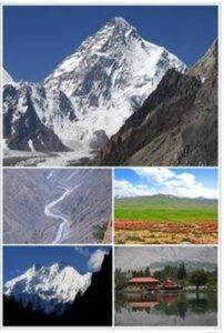
3.5 Overview of Gilgit Baltistan
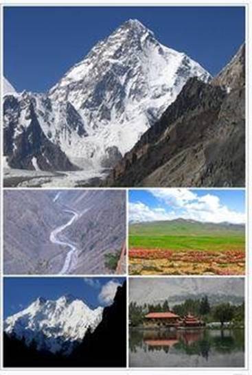
Gilgit-Baltistan, formerly referred to as the Northern Areas, functions as an administrative territory administered by Pakistan, constituting the northern segment within the broader Kashmir region. This region, embedded within the larger Kashmir conflict between Pakistan and India, encompasses all five of Pakistan’s
“eight-thousanders” and boasts over fifty peaks towering above 7,000 meters (23,000 ft). Gilgit and Skardu serve as the primary hubs for mountaineering expeditions in this area, home to some of the planet’s loftiest mountain ranges, including the Karakoram and the western Himalayas. Positioned to the north are the Pamir Mountains, while the Hindu Kush lies to the west, featuring colossal summits like K2 (Mount GodwinAusten) and Nanga Parbat, renowned as one of the world’s most daunting mountains.
This region hosts three of the world’s longest glaciers beyond the polar regions: the Biafo Glacier, the Baltoro Glacier, and the Batura Glacier. Additionally, GilgitBaltistan boasts numerous high-altitude lakes, such as Sheosar Lake in the Deosai Plains, Naltar lakes in the Naltar Valley, Satpara Tso Lake, Katzura Tso Lake, Zharba Tso Lake, Phoroq Tso Lake, Lake Kharfak, Byarsa Tso Lake, Borith Lake, Rama Lake, Rush Lake, Kromber Lake, Barodaroksh Lake, and Ghorashi Lake, each contributing to the area’s scenic charm and natural allure.
The Deosai Plains, situated beyond the tree line, form the world’s second-highest plateau after Tibet, resting at an elevation of 4,115 meters (13,501 ft). This expansive plateau lies east of Astore, south of Skardu, and west of Ladakh, acknowledged as a national park since 1993. Encompassing an area spanning nearly 5,000 square kilometers (1,900 sq mi), Deosai remains snow-covered and isolated for over half the year, between September and May, disconnected from the rest of Astore and Baltistan during winters. The village of Deosai near Chilum chokki remains linked to the Kargil district of Ladakh through a durable all-weather road.
The climatic variations across Gilgit-Baltistan derive from its diverse topography, resulting in sharp weather fluctuations. While the eastern region experiences the moist zone of the western Himalayas, areas bordering the Karakoram and Hindu Kush exhibit notably drier climates.
| Location | ||
| O Country | : Administrative by Pakistan | |
| O Province | : Gilgit Baltistan | |
| Temperature | ||
| O Maximum Temperature | : 35 °C | |
| O Minimum Temperature | : -2.7 °C | |
| Demography | ||
| O | Total Population (2017) | : 1.49 Million |
| O | Population Density | : 21/ Km2 |
| O | Total Area | : 72,496 Km2 |
| O | Annual growth rate | : 4.85% |
| O | Literacy | : 72 % |
| O | Language | : Balti, Shina, Wakhi, Burushaski, Khowar, Domaki, Urdu |
| Boundaries | ||
| o | North | : Wakhan Corridor of Afghanistan |
| o | North East | : China’s Xinjiang Uyghur Autonomous Region |
| o | South Easte | : Indian-administered Jammu and Kashmir |
| O | West | : Khyber Pukhtunkhwa province |
| O | South | : Azad Jammu and Kashmir |
| District Administrative Units | ||
| O Divisions | :3 | |
| O Districts | :14 | |
| O Tehsils | :31 | |
| O Union Councils | :113 | |
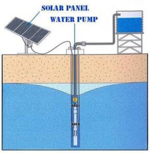
4. SOLAR WATER PUMP CONCEPT
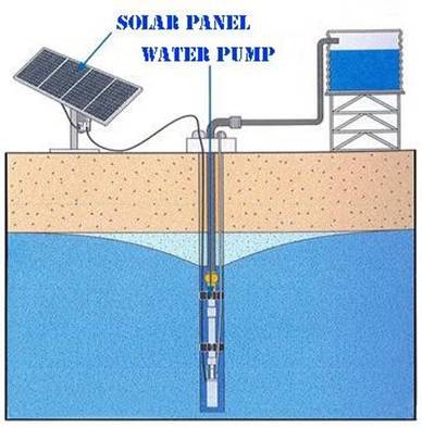
A water well is an excavation or structure created in the ground by digging, driving, boring, or drilling to access groundwater in underground aquifers. Water is extracted either manually by hand or by animal powered machnies using containers like buckets etc, or water is drawn through a pump which is usually powered by an electric motor.
Electric power can be given thorugh an electricity source normally which is an electrical supply utilities from any power supply company. In these hard to reach areas, eletrical supply from such companies is very difficult. But where the location of this area makes it a hot region and difficult to live, on the same point, it also gives maximum availability of sunlight throughout the year. Which means that sunlight could be harnessed efficiently for usage. And same energy is also used in this project as well.
Propitiously, a seasonal water drain passes nearby this area. Though the drain do not have water throughout the year, but due to presence of water in this drain seasonally, water table level becomes higher thus making it easier to extract sweet water through electrically powered pump.
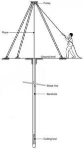
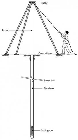
Availing the favor that has been provided naturally, bore for water well is done through Percussion Drilling Technique or Cable Tool Drilling Technique. This technique is used generally in Pakistan for water boring. In this technique, a heavy cutting or hammering bit attached to a rope or cable is lowered in the open hole or inside a temporary casing. The rhythmic raising and dropping of the bit loosens up sand or clay and breaks up rock into “cuttings” and mixes them with water added by the driller to form a slurry. The cuttings are then removed from the hole with a dart-valve bailer or other type of bailing device. When bore is drilled, it is reonforced with casings to ensure that bore does not collapse. After completion of digging a bore or well, it is ready to be equipped with water extraction technique.
Pump used for water extrcation from these boreas are also of different types. Whereas in this project, multistage centrifugal submersible pump is used. This pump is dipped deep into the water below water level alongwith motor. It pumps water to ground level and then that water is stored in tanks or any other container and used accordingly.
5. PROJECT DETAILS & STATISTICS
| Solar Power Water Plant Details | ||||
| o Solar Water Pump Quantity. | : 01 | |||
| o Solar Water Pump No. | : 05 | |||
| o Solar Water Pump Tag No. | : 05/2024 | |||
| o Total Area of Constructed Unit | : 250 ft2 | |||
| o Water pump Room Dimension (L x W) | : 17 x 15 Feet | |||
| Pump & Solar Pannel Details | ||||
| o Pump Type | : Submersible | |||
| o Pump Power | : 3 Horsepower | |||
| o Pipe Size | : 2 Inch | |||
| o Bore Depth | : 220 feet | |||
| o Water Tank Type | : Plastic | |||
| o Water Tank Quantity | : 02 | |||
| o Tank Volume | : 3974 Liter (each) | |||
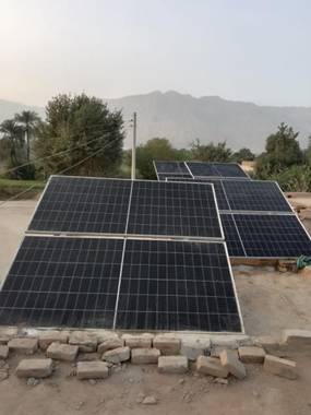
| o Solar Power Unit Capacity | : 4.50 KW | |||
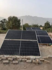
| o Solar Panels | : 8 No of 585 Watt | |||
| o Solar Inverter | : 220V, 5.5 KW, 1 unit | |||
| Location | ||||
| o | Country | : Pakistan | ||
| o | Province | : Khyber Pakhtunkhwa | ||
| o | District | : Dera Ismail Khan | ||
| o | Tehsil | : Paharpur | ||
| o | Union Council | : Katchi Kath Garh | ||
| o | Village | : Judgan Wala | ||
| Dates | ||||
| o | Project start Date | : August 06, 2024 | ||
| o | Project Completion Date | : November 05, 2024 | ||
| o | Inauguration Date | : November 10, 2024 | ||
| O | Inaugurator Name | : Qonain Zahra | ||
| Beneficiaries | ||||
| o Male | : 50 | |||
| o Female | : 80 | |||
| o Children | : 110 | |||
| o Livestock | : 300 | |||
| Distance | ||||
| o Pump distance from Tehsil | : 10 Kilometers | |||
| o Water source distance before Pump | : 3000 Meter | |||
| o Water source distance after Pump | : 30 Meter | |||
| Duration | ||||
| o Travel duration before Pump | : 60 Minutes | |||
| o Travel duration after Pump
|
: 10 Minutes | |||
6. SPONSORSHIP
Sponsorship details are:
- Sponsored by : Aqeel Project
Hadi Shahzad, Ayesha Liu Randhawa
- Sponsored in the Name of : Aqeel Project
Hadi Shahzad, Ayesha Liu Randhawa
7. PROJECT EXECUTION
- On the request of the village’s residents, it was decided to resolve the issue of clean drinking water for the inhabitants. A solar powered water plant was installed.
- A committee of local volunteers was established for construction and installation of a solar powered water plant. A meeting of the committee was held, and the initial plan was drafted.
- A vendor was selected after taking quotations from 04 contractors.
- The vendor performed a site visit. The purchase order was placed after verification of vendor organization’s registration.
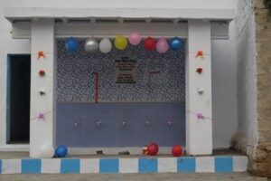
- A room for the solar powered water plant was constructed. Tiles were installed at the water filling point area.
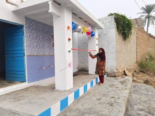
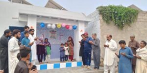
- Solar panels were installed on the roof of project equipped with aluminum frames grounded with rowel bolts by vendor’s team. Solar Powered water plant was commissioned after test run. The water plant was inaugurated. Sweets and food were distributed among villagers at the inauguration of the plant.
- To monitor the progress of the project various site visits were performed by the project team & local committee members.
- All the villagers were extremely pleased and thanked.
8. SERVICES PROVIDED
8.1 Local Volunteers
- Hamid Malik
- Murid Kazim
- Hafiz Muhammad Abdullah
- Muhammad Ehsan Bashir